Road News March 2026
Butner Road closures
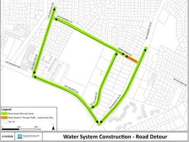
March 3-4, April 15-16, 8 am-5 pm, Downing St-Murray Bl
Daytime road closure for waterline installation from Tualatin Valley Water District. Read this release or contact 503-848-3000 for more information.
ODOT online Open House for future projects
Through March 20
Oregon Department of Transportation (ODOT) is conducting an online Open House to get input on proposed projects for the 2027-2030 State Transportation Improvement Program (STIP). Visit the page to see an interactive map with information about each project, and tell ODOT which projects you support and whether you know of impacts they should address.
One proposed project is in Cedar Mill, the Cornell Rd-Saltzman Rd Transit Access project. “Cedar Mill Town Center area project will improve bus reliability and provide safe access to transit along Cornell and Barnes roads, and improve pedestrian and bicycle safety by adding mix enhanced pedestrian crossings, median islands, ADA-accessible ramps, left turn bike box, and intersection bike signals.”
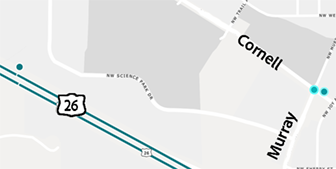
Another nearby project is to begin design for the Westside Trail Pedestrian & Bike Bridge over US26 (THPRD). “Preliminary design for the construction of a pedestrian and bike bridge over US26 with a trail and ramp segment either side of US26 connecting NW Cornell Rd with NW Greenbrier Parkway. The ramp on the northern side consists of a separate bridge over a wetland.” Read more in the Parks article, and take THPRD’s survey at Westside Trail Community Survey.
The ODOT Open House is open for comments through March 20.